Amir Wagner · 14 October 2026
Investigating Erosion Patterns in Natural Rock Overhangs and Their Effects on Long-Term Structural Integrity Within Arid Zone Formations
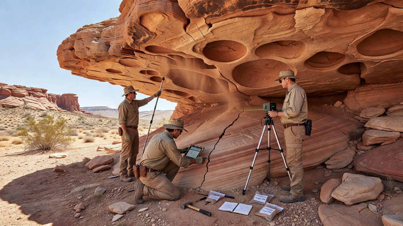
Arid zone formations present unique challenges for geologists studying rock overhangs, where low precipitation combines with extreme temperature fluctuations to drive specific erosion processes; researchers have documented how wind abrasion, salt weathering, and occasional flash flood events interact over centuries to shape these structures. Data from multiple field sites across the American Southwest and central Australia show that overhangs develop characteristic patterns including undercut bases, exfoliation joints, and localized pitting that compromise overall stability. Those who've studied these environments note that structural integrity assessments rely on measuring fracture propagation rates, which accelerate during seasonal thermal cycles when rock expands and contracts rapidly.
Mechanisms Driving Erosion in Dry Climates
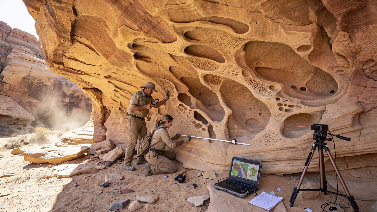
Wind carries abrasive particles that scour exposed surfaces while salt crystals expand within pores during rare moisture events, and this combination creates microfractures that widen over time. Thermal stress from daytime highs exceeding 40 degrees Celsius followed by nighttime drops below freezing contributes additional strain, particularly on sandstone and limestone overhangs common in arid regions. Studies conducted by teams at the University of Arizona reveal that overhangs oriented toward prevailing winds erode faster on windward faces, whereas leeward sides accumulate protective debris that slows further degradation. Observers note that these differential rates produce asymmetric profiles that shift the center of gravity outward, increasing the likelihood of slab failure during infrequent but intense rainfall.
Documented Patterns Across Study Sites
Long-term monitoring programs have identified recurring sequences where initial surface roughening precedes deeper undercutting, followed by block detachment along bedding planes. In formations like those near Uluru in Australia, researchers mapped overhang evolution using LiDAR scans collected over five-year intervals, and results indicate average recession rates of 0.2 to 0.8 millimeters annually depending on rock type and exposure. Similar measurements from Nevada test sites show comparable figures, confirming that arid conditions concentrate erosion at the drip line where occasional water concentrates. What's interesting is how biological crusts and lichen colonies temporarily stabilize certain surfaces until physical processes eventually dislodge them, restarting the cycle.
Assessment Techniques for Structural Integrity
Engineers and geomorphologists combine non-invasive methods such as ground-penetrating radar with direct sampling of core material to evaluate load-bearing capacity beneath overhangs. Acoustic emission sensors detect micro-crack development in real time, allowing teams to correlate environmental triggers with internal stress accumulation. Data collected during a 2024 expedition in the Mojave Desert demonstrated that overhangs with extensive undercutting displayed 35 percent lower shear strength compared to intact sections, according to measurements reported by the US Geological Survey. These findings guide decisions on whether areas require restricted access or protective barriers to prevent collapse onto trails or archaeological resources below.
Continued monitoring programs plan additional surveys in October 2026 to capture any acceleration linked to shifting climate patterns, and preliminary models suggest that increased frequency of extreme heat events could raise erosion rates by 15 to 25 percent in vulnerable zones. Australian researchers from Geoscience Australia have contributed comparable datasets from the Pilbara region, highlighting how regional geology influences response times to the same climatic drivers. Integration of satellite imagery with on-site instrumentation provides broader context for predicting when overhangs transition from gradual recession to sudden failure.
Implications for Conservation and Land Management
Land managers apply erosion data when designing visitor infrastructure and protecting cultural heritage sites sheltered beneath overhangs. In regions where indigenous rock art survives on sheltered walls, accelerated undercutting threatens both the artwork and the structural canopy above it. Mitigation strategies include installing drainage diversions that reduce water concentration at critical points, while leaving natural processes intact elsewhere. Figures from multi-year inventories indicate that approximately 12 percent of documented overhangs in monitored arid basins show advanced instability requiring intervention within the next two decades.
Conclusion
Investigation of erosion patterns continues to refine understanding of how arid zone overhangs lose integrity over extended timescales. Coordinated efforts between government agencies, universities, and field researchers produce datasets that support predictive modeling and targeted conservation measures. As monitoring expands through 2026 and beyond, these insights help balance public access with preservation of both geological features and associated cultural resources.